Category:Église Notre-Dame-de-Pitié de La Chapelle-Blanche (Côtes-d'Armor)
Jump to navigation
Jump to search

| Object location | | View all coordinates using: OpenStreetMap - Google Earth - Proximityrama |
|---|
|
This building is indexed in the Base Mérimée, a database of architectural heritage maintained by the French Ministry of Culture, under the reference IA00004727
|
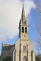
church located in Côtes-d'Armor, in France  | |||
| Upload media | |||
| Instance of | church building | ||
|---|---|---|---|
| Location | La Chapelle-Blanche, canton of Caulnes, arrondissement of Dinan, Côtes-d'Armor, Brittany, France | ||
| Heritage designation | |||

| |||
| |||
Media in category "Église Notre-Dame-de-Pitié de La Chapelle-Blanche (Côtes-d'Armor)"
The following 4 files are in this category, out of 4 total.
_Église_01.JPG/90px-La_Chapelle-Blanche_(22)_Église_01.JPG) La Chapelle-Blanche (22) Église 01.JPG 1,659 × 2,212; 1.1 MB
La Chapelle-Blanche (22) Église 01.JPG 1,659 × 2,212; 1.1 MB
_Église_02.JPG/120px-La_Chapelle-Blanche_(22)_Église_02.JPG) La Chapelle-Blanche (22) Église 02.JPG 1,780 × 1,398; 918 KB
La Chapelle-Blanche (22) Église 02.JPG 1,780 × 1,398; 918 KB
 La Chapelle-Blanche22 - Église Notre-Dame-de-Pitié.JPG 3,678 × 5,517; 4.24 MB
 Église de La Chapelle-Blanche 3.JPG 3,216 × 4,288; 2.65 MB
_Église_01.JPG)
_Église_02.JPG)
